The Motorway 72 between Chemnitz and Leipzig is almost completed, yet we are starting to see many fancy bridges crossing the motorway that will be 169 km long from Hof to Leipzig when construction ends by 2026. Apart from the tall viaducts built in the 1930s between Hof (Bavaria) and Chemnitz, we are seeing tall modern viaducts and welded metal bridges popping up in the past decade.
Apart from the one at the interchange with the Motorway 38 south of Leipzig (see my previous article by clicking here), we have this “shoe-shaped” cantilever Warren truss bridge located near Penig, about 15 km north of Chemnitz. The truss design was constructed in 2014 and serves as a pedestrian crossing. This bridge is one of the most attractive of the new overpasses along this stretch of Motorway, yet having to photograph it is difficult with all the traffic that accompanies travel. One has to photograph it from the car or simply pull over to get a shot. Both have setbacks, with the latter option being dangerous because of the high volume of traffic combined with the risk of an accident.
I chose the lesser of the evils with a drive-by shooting, which is best done from a passenger seat. Taken with a Smartphone, one has an opportunity to take multiple shots, assuming the phone does not take its time with the focusing. Nevertheless, one can see its entire length and its design contraption. It’s not the best shot but one that shows its true colors, despite the emmission tags and smudging on the windows.
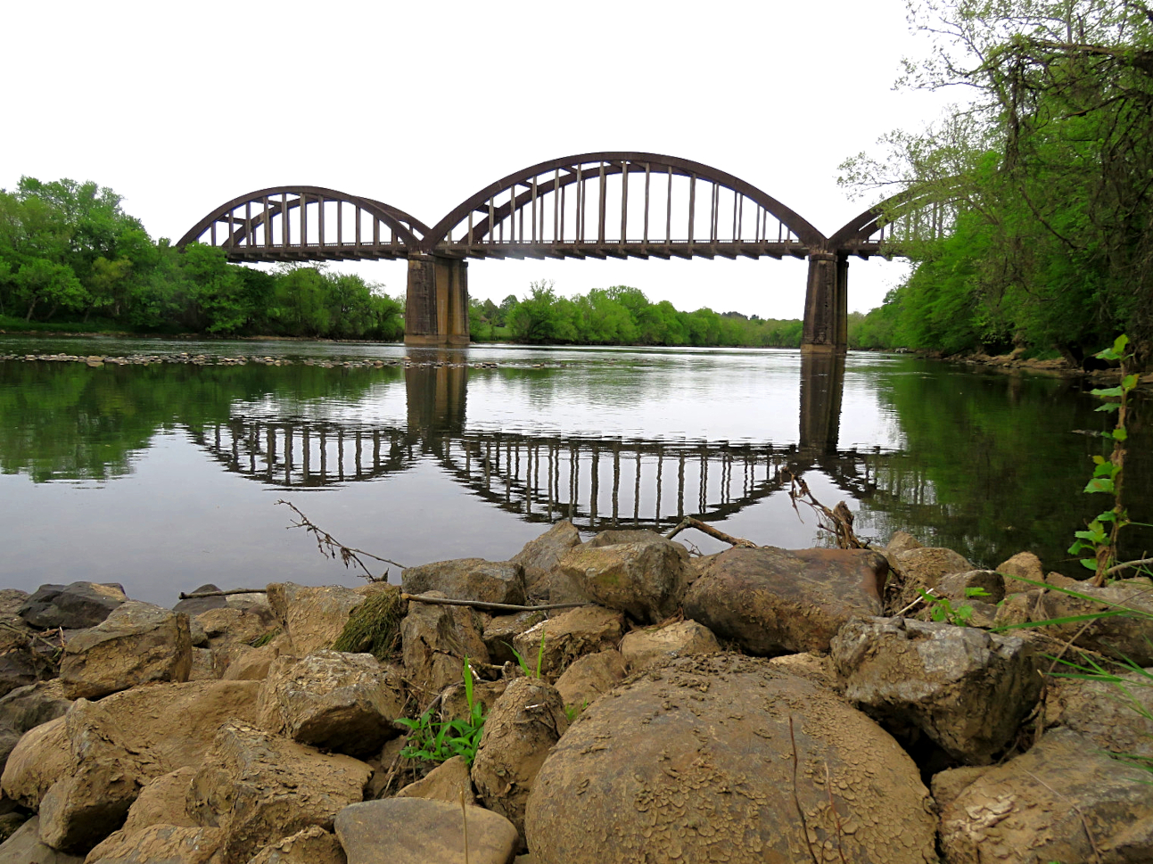
Michigan’s first network tied-arch bridge stands on Second Avenue in Detroit. It replaced a standard girder overpass erected in 1954 as part of the comprehensive rebuild of Interstate 94 in the area.
This distinctive design was selected for its unobstructed span, negating the necessity for central support in the expanded section of Interstate 94. This arrangement facilitated uninterrupted traffic flow on Interstate 94 and at its intersection with M-10. Equally notable was its assembly process: the bridge was constructed off-site and transported to the location using self-propelled, self-leveling mobile carriers.
The newly constructed Second Avenue Bridge opened for vehicular traffic on October 27, 2023.
The article is courtesy of Sherman Cahal; you can find more photos on this new structure by clicking here.
This week’s Postcard profile also features a Pop Quiz. This bridge is located in Germany and is the only structure of its kind that exists. It features a centilever truss span that functions as a swing bridge, where the spans swing outwards to allow ships to pass. Such bridges existed between 1880 and 1960, including another span in Rendsburg over the Baltic-North Sea Canal. That span was built in 1895 by Friedrich Voss and was in service until its replacement with a tunnel in 1960.
Yet this bridge is not found in Schleswig-Holstein. Where is this structure located?
A. Bremerhaven
B. Hamburg
C. Kiel
D. Berlin
E. Rostock
F. Magdeburg
.
The answer will come next week. Good luck and remember: Your Bridge Matters! 🙂 ❤
In his monthly series “Bridging Time”, fellow pontist Calvin Sneed travels to parts of the central and eastern US to profile some of the fanciest historic bridges in the region. The BHC is profiling one of his bridges from the series. It’s one of the later forms of the Rainbow Arch Bridge patented by James B. Marsh, but this one is a bit unique for its aesthetic appearance and its history. Here’s the story about the McBee Bridge in Tennessee:
East Tennessee is home to four open-spandrel concrete deck arch bridges. The Hammond Bridge in Kingsport, the Henley Street Bridge in Knoxville, the Time-Line Bridge at Westel, Tennessee and the Wolf Creek Bridge east of Newport… spectacular, sweeping deck arches underneath the highway surface.
But take those same bridges and turn them upside down! The bridge type then becomes a concrete “through” arch bridge in the shape of a rainbow. Coincidentally, the Holston River is also home to the only concrete through arch bridge in the state of Tennessee. It’s the McBee Bridge on the Knox-Jefferson County line at Strawberry Plains.
The Holston River flowing down from Kingsport has always had various ferries along its 142 miles, according to Bill Carey, founder of TN History for Kids. Along the route downriver in the 19th and early 20th centuries, he noted a Hawkins County ferry busy operating at Christian’s Bend in the river, along with Melinda’s Ferry southwest of Rogersville, also in Hawkins County. Further down, Long’s Ferry in Grainger-Hamblen County, Noe’s Ferry in Grainger-Hamblen County, Smith’s Ferry and Nance’s Ferry, both crossing the Holston River between Grainger and Jefferson Counties were among the many landings where ferries were located, some of them with no name historically recorded.
According to a historical marker on the Andrew Johnson Highway U.S. 11-E, many early travelers from North Carolina, reported using the McBee Ferry that crossed the shallow Holston River at the current Southern Railroad bridge in a bend of the river at Strawberry Plains. It took a couple of visits from his native Virginia, but William McBee quickly saw the need for a ferry of some sort to replace the rocky ford in the river, so he established one in 1792, about 2,500 feet downriver from the railroad bridge. It quickly became one of the busiest ferry crossings on the Holston-French Broad watershed because it was near the junction of the two rivers. It’s been written that more travelers crossed the river at McBee Ferry because it automatically put travelers on the north side of the river for downtown Knoxville, rather than having them wait in line for the crowded ferries and bridges downtown. A toll bridge replaced the McBee Ferry in the early 1830’s, but was destroyed in a flood and the ferry resumed into the 20th century.
In 1929, the proposed McBee Bridge was one of two bridges approved by Knox County to replace a couple of river ferries. A planned “deck” arch bridge at the McBee Ferry (similar to the Henley Street Bridge at Knoxville and the Hammond Bridge at Kingsport) was abandoned because the deck arches underneath the road surface would not have been tall enough to clear the Southern Railroad tracks that also ran along the riverbank. As a result, designer Freeland-Roberts (an engineering firm that still exists), designed a concrete “through” arch bridge for McBee flipping the arches high above the road surface, hence an “upside down Henley-Hammond Bridge.”
At 785 feet carrying Mascot Road over the Holston River, the McBee Bridge is still one of the largest rainbow arch bridges in the United States. It was built by the Southern Bridge Company of Birmingham, Alabama and was completed in 1930. It has three, open-spandrel concrete tied rainbow arches with enormous ribs, sometimes referred to as bowstring arches, along with five concrete tee-beam approach spans on the north side of the river. The middle river channel span is 222.5 feet, and the two spans on either side of the channel span are 165 feet long each. The original bridge contained two traffic lanes and a sidewalk; the sidewalk was removed in 1979 to allow the width of the lanes to be widened, accommodating heavy trucks from nearby rock quarries.
At the site of the former McBee Ferry about 18-hundred feet north of the bridge is the new McBee Ferry Landing river access park that celebrates the history of one of the busiest ferries in East Tennessee. The remains of the approach ramps into the river still exist after more than 175 years, now providing access to canoeing, fishing, kayaking, birdwatching and taking a leisurely float underneath a lazy, but massive concrete Holston River rainbow bridge, about 21 miles upriver from downtown Knoxville.
If you visit Vermont and are looking for unique historic bridges, this one in Brookfield is the one to check out because of its history and design. Caitlin O’Shea of Preservation in Pink has the story….
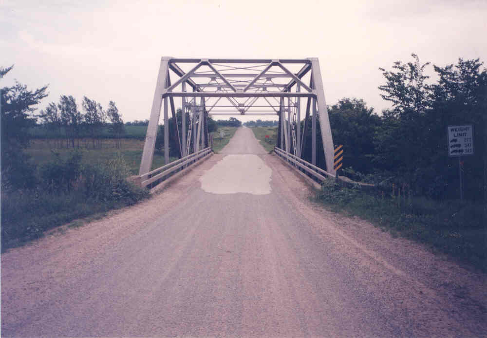
This week’s BHC Pic of the Week takes us back to 1998 and to the state of Iowa. Starting north of Albert Lea, MN and emptying into the Cedar River near Janesville, the Shell Rock River is a river full of surprises as far as bridges are concerned. As many as ten through truss bridges, two bowstring arches, one steel viaduct and five concrete arch crossings once spanned one of the shortest rivers in the state, which crosses four counties in Iowa (Worth, Cerro Gordo, Floyd, Butler and Black Hawk) and one in Minnesota (Freeborn), including the longest Pennsylvania through truss bridge in the state, the Traer Street Bridge in Greene, the Gates Truss Bridge at the Floyd- Butler border, a Thacher through truss bridge near a dance hall near Northwood and the Rock Grove Bowstring Arch Bridge near Nora Springs. All four of them were no longer in service when I explored the river in 1998-99. At that time, we had half of these historic bridges still standing…..
……including two in the village of Plymouth in Cerro Gordo County, both of them through truss spans. Yet they replaced two iron bridges that were destroyed in accidents, according to records from the highway department in Mason City. This bridge was one of them, located north of Strand Park just outside of town.
The Pratt through truss bridge had M-frame portals and riveted connections. It was 100 feet long but a vertical clearance of about 12.5 feet from the road. It was built in 1950 replacing a truss bridge which was destroyed when a collision involving a car happened there. Unfortunately one person was killed in the incident. The bridge had been built at a sharp angle, which was typical for construction during the last three decades of the 1800s. The truss bridge that was destroyed had existed since the early 1880s, according to records. Because of the scarcity of steel and gravel for bridge construction combined with recovering costs from World War II, the bridge was built cheeply, using a standardized design created 25 years earlier by the now present-day Iowa DOT.
The bridge looked just like new when I first visited the structure in the summer of 1998. The best shot was the portal shot as it was flanked by trees on both sides. Nevertheless, I was impressed that it was kept up as well as it did. I visited the structure again in the fall, where I found the city’s other structure on the south end, and once more with my wife in 2005 enroute to Minnesota for my Grandma’s 90th birthday party. No weight limit nor any rust or other problems.
Still the height was an issue and that led to its demise in 2010. It was one of those acts which was senseless because it was such a young bridge. Nevertheless, it represented progress , something which makes me ask myself whether it was a necessity to take a piece of history away when it still had a lot of life left in the gas tank.
Bridge Nr. 226, the tallest viaduct along the Railway. Source: A.M.Hurrell via Wiki Commons
The railroad line is 96km, it has 107 tunnels, 900 sharp turns and around 850 bridges!!! It was first brought up by a journalist of a newspaper in Delhi in 1847, but it took 66 years, including the actual construction of eight years before it became a reality and opened to traffic in 1903. The line crosses rugged mountains and forests, crossing steep valleys and giving rail passengers with the most awesome views but at the same time the biggest whiplashes because of its sharpest curves of up to 48° angles! Nevertheless, the journey is worth the experience if you want to travel on the wild side.
The Kalka-Shimla Railroad is a narrow-gauge railway located in the Himachal Pradesh Province in northern India, located two hours by bird flight south of Kashmir. Connecting Kalka with the province’s capital, the railroad line has one of the highest density of bridges in the world, with one crossing every kilometer, predomonantly built of brick and including one of the world’s highest bridges, The Art Gallery Bridge (known as Bridge Nr. 226), a 91-foot tall bridge built in five layers of arches. Its height competes with the four brick viaducts in the Vogtland Region in Saxony.
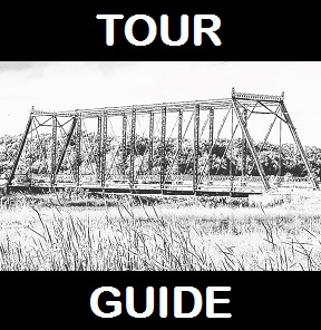
The Darjeeling Himalayan Railway Society has put together a tour guide of the bridges and tunnels along the Kalka-Shimla Railway to provide you with an insight of the structures that exist in this mountainous region laden with forests and deep valleys. It looks at some of the best structures one can see while traveling the route or hiking in the region.
Click on the link below to access this guide and enjoy reading about the structures. 🙂
This is a blog about my project of visiting every bridge over the Genesee River and what I learned about the history, structure, and natural surroundings of each bridge.